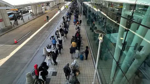
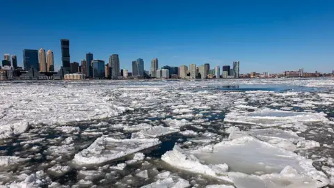
A weekend storm sent temperatures plunging well below zero in the Midwest and dumped heavy snow on parts of the Northeast on Sunday, creating many airport delays and slick roads as the Pacific Northwest braced for more rain after days of flooding and mudslides. The storm began Saturday and brought several inches of snow in the New York-New Jersey metro area, marking the region's first significant snowfall of the season. Light snow also fell over parts of New England. The storm was expected to weaken by Sunday night, followed by arctic conditions with wind chill temperatures plummeting to -10 degrees Fahrenheit (-23 Celsius) in places like Minneapolis. Crews were deployed in New Jersey to plow and salt roads, while Ohio and Pennsylvania implemented speed limit reductions on highways to ensure safety. National Weather Service's reports indicated it was the coldest morning of the season thus far. Meanwhile, as the Midwest grapples with freezing temperatures, the Pacific Northwest remains on alert for more rain and potential wind events, exacerbating ongoing issues from recent severe flooding.
Midwest Plunges into Arctic Conditions as Winter Storm Disrupts Travel

Midwest Plunges into Arctic Conditions as Winter Storm Disrupts Travel
A significant winter storm has brought heavy snowfall to the Northeast and arctic air to the Midwest, causing widespread travel disruptions and hazardous conditions on roadways. Over 1,000 flights were delayed across the U.S.
A winter storm has plunged temperatures below zero in the Midwest while blanketing parts of the Northeast with snow, leading to substantial flight delays and road hazards. Authorities urge minimal travel as crews work to clear affected areas. The arctic blast and upcoming weather complications in the Pacific Northwest raise concerns about ongoing evacuations due to previous flooding.